Looking for your apps? Click the account icon in the upper right corner of the page.

Add a new control point

The Local tab on the Control point screen is where to add the control points from a project. One control point from a GPS measurement can also be made there. Select Control Point to add a control point from an existing project file.
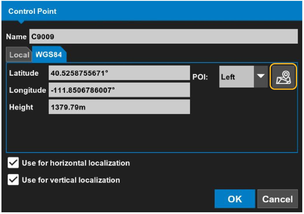
The WGS84 tab shows the selections to get one GPS measurement. This automatically enters the latitude, longitude, and height. WGS84 is recommended for a small project site in which 1-point localization is necessary.
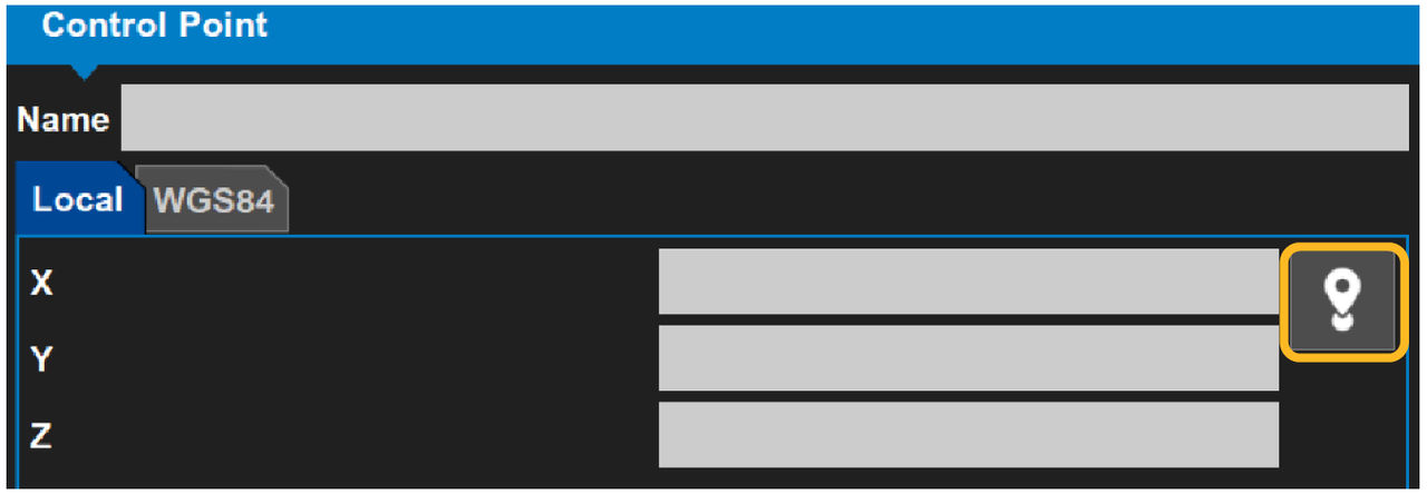
Figure: Add a new control point
The Grid tab can show, not the WGS84 tab. To replace Grid with WGS84, select the Coord. system tab to change the control point to GPS localization.
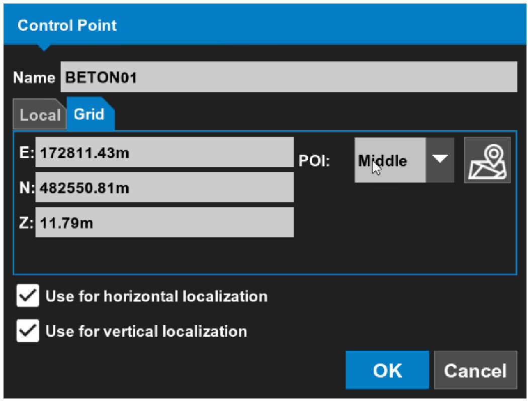
Figure: Grid tab
  1. Select DataControl.
    ADDITIONAL INFORMATION:
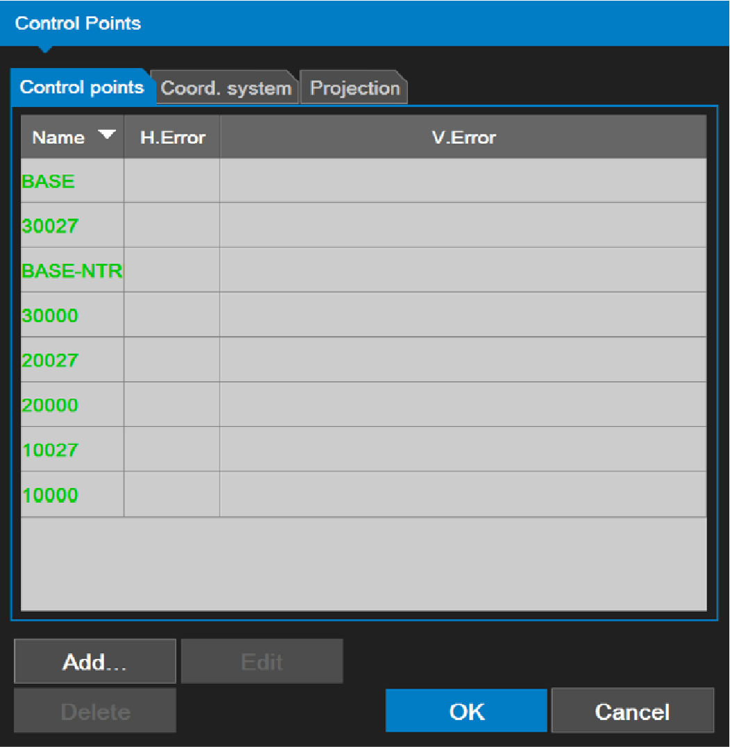
    The Control Points screen opens to the Control points tab.
  2. Select Add.
    ADDITIONAL INFORMATION:
    Figure: Control points screen control points tab
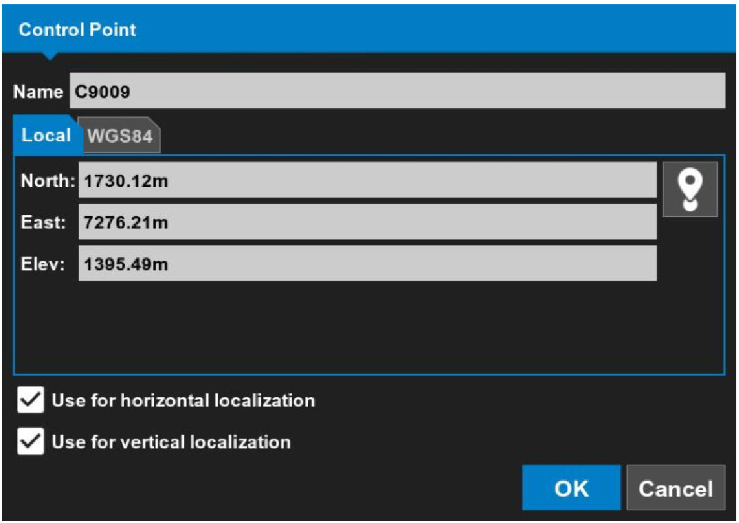
    ADDITIONAL INFORMATION: The Control Point dialog opens.
  3. Enter a Name for the control point file.
  4. Enter the values for North:, East:, and Elev:.
  5. Select the Use for horizontal localization and Use for vertical localization checkboxes.
    ADDITIONAL INFORMATION:
    Figure: Control point
  6. If 1-point localization is necessary, select the WGS84 tab, then select Control Point.
    ADDITIONAL INFORMATION:
    3D-MC takes a GPS measurement and enters the Latitude, Longitude, and Height.
  7. Select the localization checkboxes for GPS localization.
  8. Select OK to go back to the Control points tab.
    ADDITIONAL INFORMATION:
    Figure: Select control point

myTopcon NOW! support

Take your Topcon experience to the next level with myTopcon NOW! This platform is a self-service tool for your desktop or mobile device. 

Product manuals
paper icon
Communications
phone icon
E-learning
hat icon
Quick start guides
support icon
Firmware & software updates
cloud icon
Troubleshooting
webinars icon